

Our Services
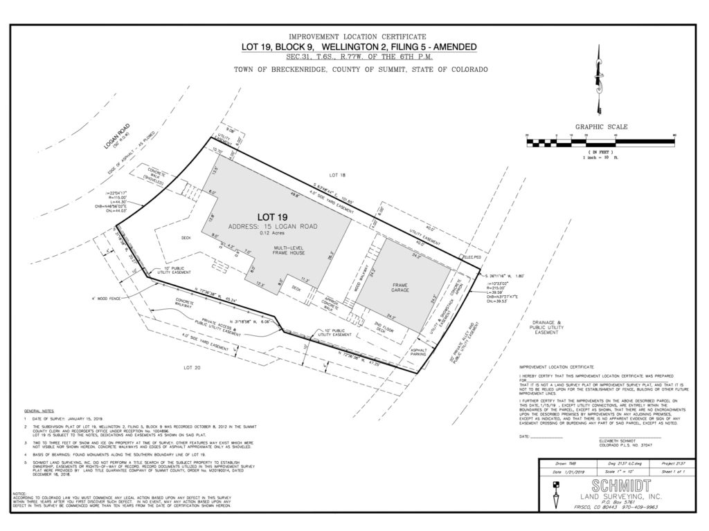
IMPROVEMENT LOCATION CERTIFICATE
An “ILC” or Improvement Location Certificate is typically used by mortgage and/or title companies and ordered by a real estate agent during a residential real estate transaction. This Certificate shows the recorded boundary information and the existing improvements (e.g. house, fence, driveways) on the parcel of land. Apparent encroachments shall be noted and shown in an obvious manner. Improvement Location Certificates are not property boundary surveys and property corner monuments are not required to be found or set at the lot corners.
LAND SURVEY PLAT
The Land Survey Plat or “boundary” survey requires all property corner monuments to be found or set. Recorded Plats and deeds are used along with precise field measurements taken of existing monuments and field evidence in order to determine the location of the property corners. A plat is drafted to show a representation of the land surveyed including any conflicting boundary evidence or visible encroachments. If a current title commitment has been provided, the land survey plat will show easements, rights-of-way and other items which may affect the subject property.
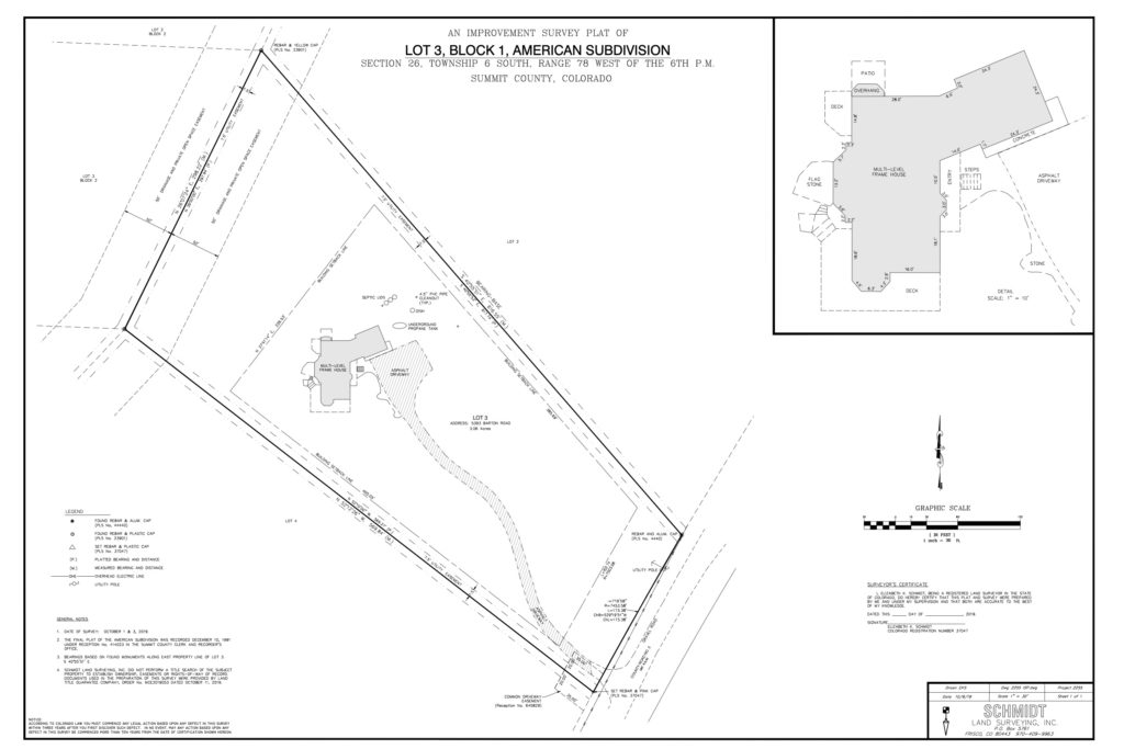
IMPROVEMENT SURVEY PLAT
An Improvement Survey Plat is similar to a Land Survey Plat but is used to also show improvements such as buildings, fences, walkways, decks or other visible features.
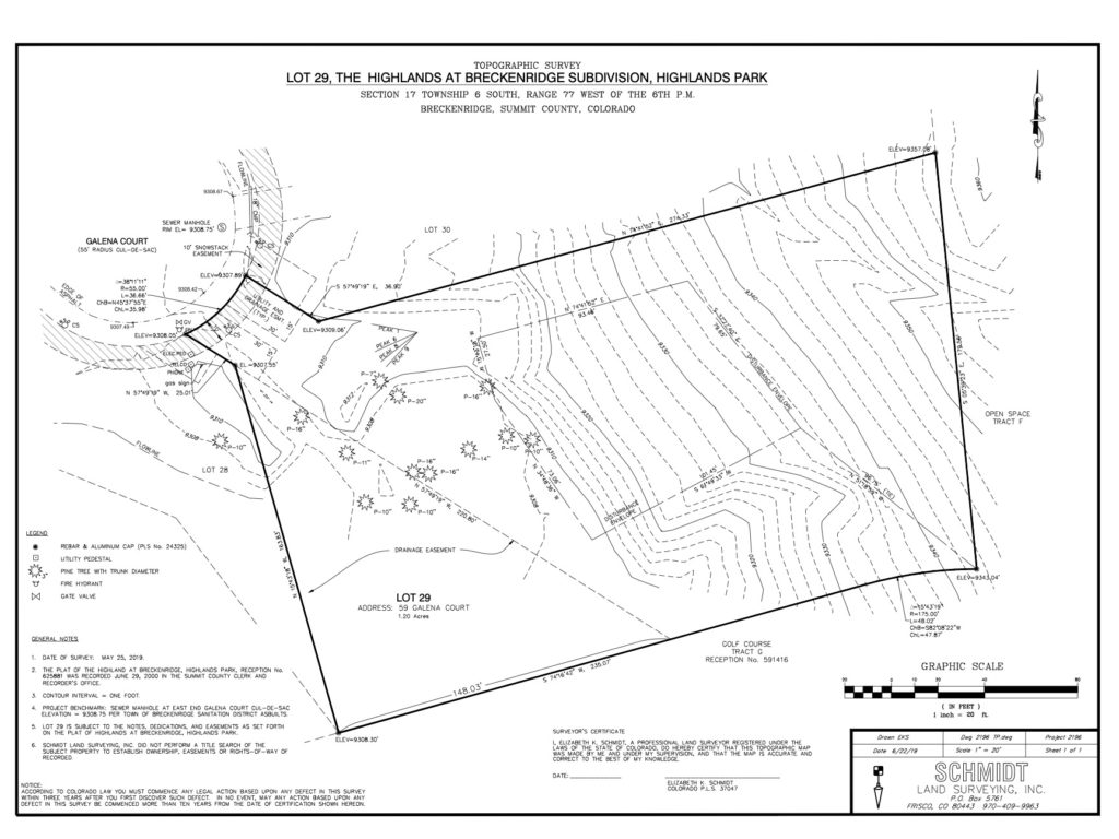
TOPOGRAPHIC SURVEY
A topographic map is a drawing that gathers elevation data of points on a parcel of land and presents them as contour lines. Usually a “one foot” or “two foot” contour interval is used. An engineer may need a “topo” to design driveways, improve drainage or create infrastructure.
A topographic map is often requested by an architect to determine the most optimal location for a new house. Existing house elevations and or ridge heights can be shown if a new design for an addition is needed.
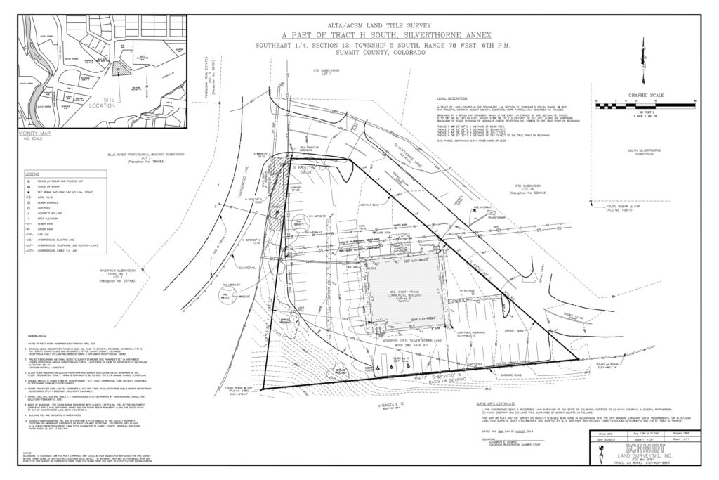
ALTA/NSPS LAND TITLE SURVEY
This survey is defined by the National Society of Professional Surveyors and the American Congress of Surveying & Mapping. An ALTA survey is often requested for the sale of commercial properties and is requested by lenders, corporations and title companies for the development of commercial properties. An ALTA survey follows a more stringent set of requirements than a Land or Improvement Survey plat. Table “A” will be needed before this survey can be commenced with all requirements checked such as topography or Flood plain information.
CONSTRUCTION SURVEYING
Construction Surveying is requested prior to commencing any building on a new project. The survey crew will “layout” the location of building corners, roads, utilities or concrete work that has been designed by an engineer or architect. This ensures that the building does not encroach over any building setbacks, easements or property lines. Horizontal and Vertical information is indicated on lathe or stakes in reference to spikes or rebar.